
Bridgeview
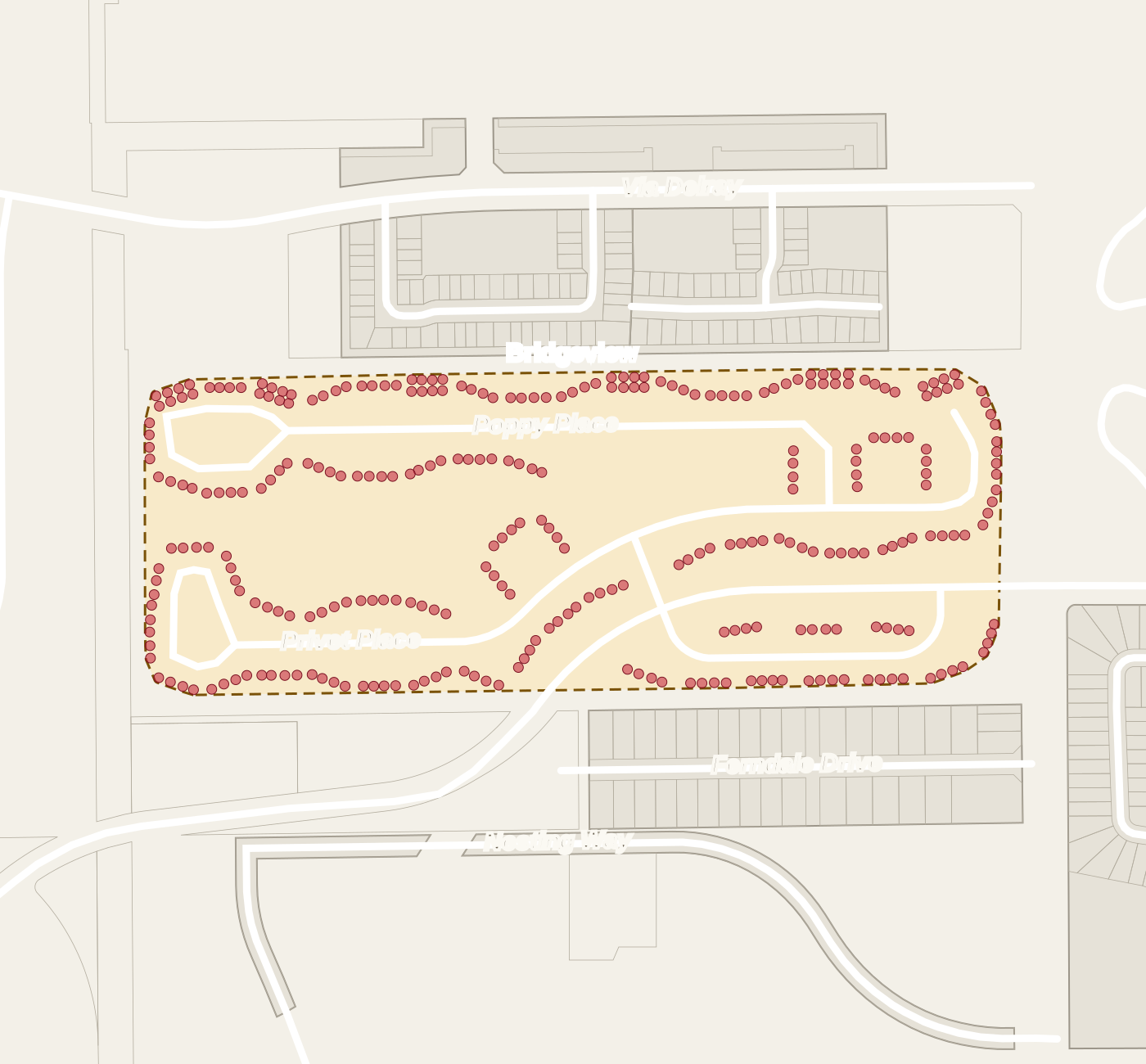
Bridgeview is in unincorporated Palm Beach County, Florida. No municipal boundary contains it. Its mailing address is Delray Beach 33484, which is a postal designation and not a municipal boundary.
Bridgeview is a community of 300 condominium units. It lies outside every municipal boundary, in unincorporated Palm Beach County. Interstate 95 is about 2.4 road miles away.
Bridgeview is a community of 300 condominium units. It lies outside every municipal boundary, in unincorporated Palm Beach County. Its mailing address is Delray Beach, Florida 33484. The county property table lists each of its 300 units as a separate condominium parcel. Its units have street addresses on Privet Place, Poppy Place and Petal Place. The county's plat and parcel maps show no recorded plat or parcel outline for Bridgeview; its units appear as address points.
Interstate 95 is about 2.4 road miles away and Florida's Turnpike about 4. Downtown Delray Beach, where Atlantic Avenue meets Swinton Avenue, is about 3.9 road miles away. Delray Beach Municipal Beach is about 4.8 road miles away.
Bexley Trail Community Park is a public park about 0.8 road miles away. Bridgeview lies outside the county's designated hurricane evacuation zones.
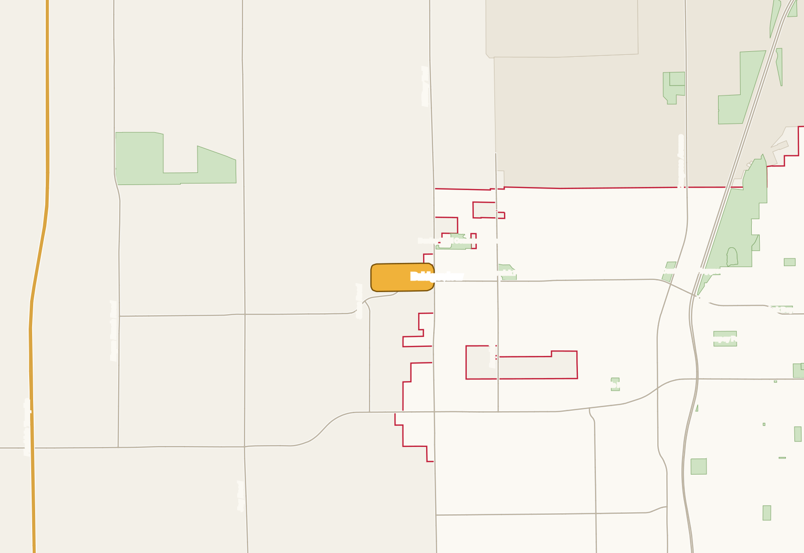
Where is Bridgeview on the map?
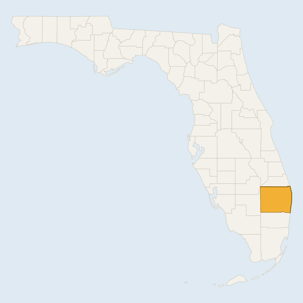
Step 1: Florida Drawn from U.S. Census Bureau cartographic boundaries. 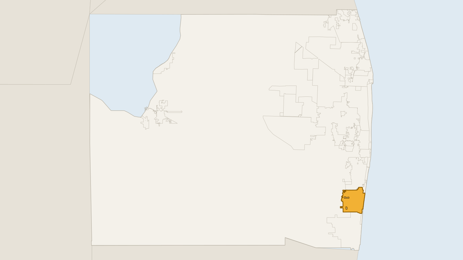
Step 2: Palm Beach County Drawn from Palm Beach County open-data boundary layers. 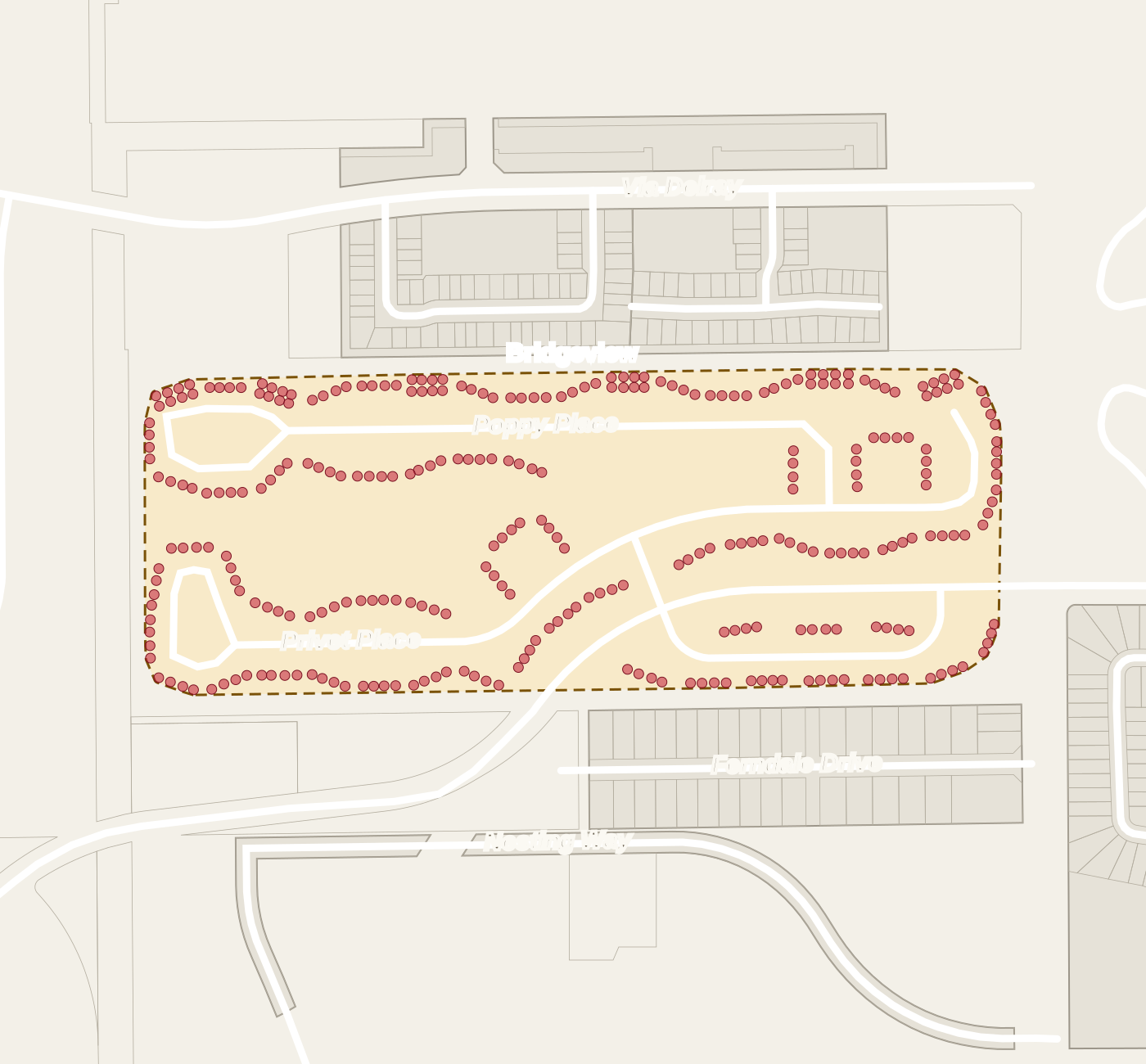
Step 3: Bridgeview Drawn from the county's address points for its units.
What is Bridgeview made of?
County property records list 300 condominium parcels under the name BRIDGEVIEW COND.
Which streets are inside Bridgeview?
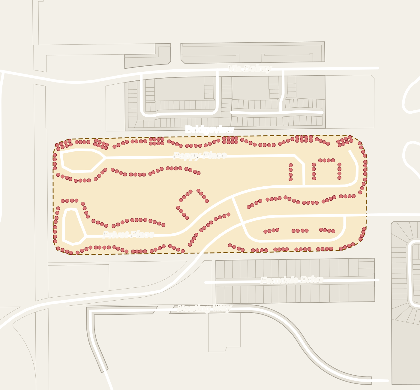
County parcel records list addresses inside Bridgeview on these streets, with the number of addresses on each: Privet Place (140), Poppy Place (120) and Petal Place (40).
How far is Bridgeview from the highways, downtown and the beach?
From Bridgeview, Interstate 95 is about 2.4 road miles and Florida's Turnpike about 4. Downtown Delray Beach is about 3.9 road miles. Delray Beach Municipal Beach is about 4.8 road miles.
Which parks are near Bridgeview?
Bexley Trail Community Park, a city park, is about 0.8 road miles away. Barwick Park, a city park, is about 0.9 road miles away. Family Recreation Center and Playground, a city park, is about 2.2 road miles away. Pompey Park, a city park, is about 2.8 road miles away. Eagle Park, a city park, is about 2.9 road miles away. Within 3 road miles there are 5 public parks and natural areas, and within 5 road miles there are 44.
Is Bridgeview in the city of Delray Beach?
No. Bridgeview has a Delray Beach mailing address but lies outside every municipal boundary, in unincorporated Palm Beach County.
What kind of homes are in Bridgeview?
Condominium homes. County property records list 300 condominium parcels under the name BRIDGEVIEW COND.
Is Bridgeview a condominium?
Yes. County property records class all 300 of its unit parcels as condominium, under the name BRIDGEVIEW COND.
What is the ZIP code for Bridgeview?
33484, with a Delray Beach mailing address.
How far is Bridgeview from I-95?
About 2.4 road miles.
Is Bridgeview in a hurricane evacuation zone?
No. It lies outside the county's designated hurricane evacuation zones.
Is there a public park within 1 road mile of Bridgeview?
Yes. Bexley Trail Community Park is about 0.8 road miles away.
How was this page built?
Every statement of fact on this page was checked against its source. The current check ran on 5 November 2026. 22 statements are confirmed by a query against a government dataset. 16 distances are calculated by us on the U.S. Census road map from places confirmed in those datasets, and are labelled as calculated.
- Palm Beach County Property Appraiser — property table — 10 statements, from a government dataset query, retrieved 5 November 2026. Evidence: observed
- Palm Beach County Municipal Parks — 9 statements, calculated by us from this dataset, retrieved 5 November 2026. Evidence: modeled
- Palm Beach County ZIP Codes — 6 statements, from a government dataset query, retrieved 5 November 2026. Evidence: observed
- U.S. Census Bureau TIGERweb — Primary Roads — 4 statements, calculated by us from this dataset, retrieved 5 November 2026. Evidence: modeled
- Palm Beach County Municipal Boundaries — 3 statements, from a government dataset query, retrieved 5 November 2026. Evidence: observed
- Palm Beach County Evacuation Zones — 2 statements, from a government dataset query, retrieved 5 November 2026. Evidence: observed
- U.S. Census Bureau TIGERweb — Local Roads — 2 statements, calculated by us from this dataset, retrieved 5 November 2026. Evidence: modeled
- Palm Beach County parcel layer (outlines) — 1 statement, from a government dataset query, retrieved 5 November 2026. Evidence: observed
- Palm Beach County parks and natural areas — 1 statement, calculated by us from this dataset, retrieved 5 November 2026. Evidence: modeled
Reviewed 5 November 2026 by Peter Mergenthaler Jr, Broker · Data as of 5 November 2026